In 1472 Portuguese navigator discovered a large island off the Guinea Coast which today is the capital of Equatorial Guinea, named Malabo. In history this site has been known to be called Fernando Po after the man who discovered it's existence. Because the island was mainly visited by the Portuguese, Portugal gained certain rights in the area. In 1778, these rights where then given to Spain.
Around the time Spain gained the rights, they also gained Yellow Fever and made little presence in Africa until around 1850. At this time, inland exploration began, and Fernando Po/Malabo became a destination for those deported from Cuba.
The Spanish did not officially settle in the mainland until the middle of the 19th century. Equatorial Guinea gained independence in 1968.
With their new found independence came new found leadership. This leadership soon turned to absolute ruling by the country's first President Francisco Macias Nguema. Macias wanted complete power, redoing the constitution and naming himself as president of Equatorial Guinea for life. One year later he gives himself absolute power over his people, preventing them from leaving the country. After his takeover of power, there began a 'Reign of Terror' with a reported 1/3 of his entire population being massacred.
In 1979 Francisco Macias Nguema is overruled by this nephew Teodoro Obiang Nguema who rules to this day doing hardly better at ruling than this uncle. (History World).
Two Websites that provide a good amount of information on Equatorial Guinea are:
CIA, The World Factbook
https://www.cia.gov/library/publications/the-world-factbook/geos/ek.html#top
Viente Mundos
http://www.veintemundos.com/en/spanish/equatorial-guinea/
Map of Equatorial Guinea
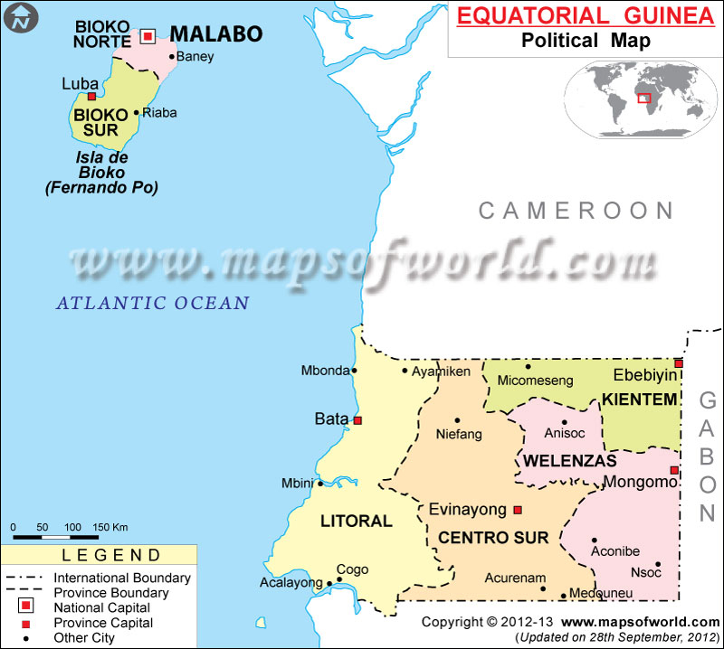
(Maps of World, 2012)
Forest Areas in Africa
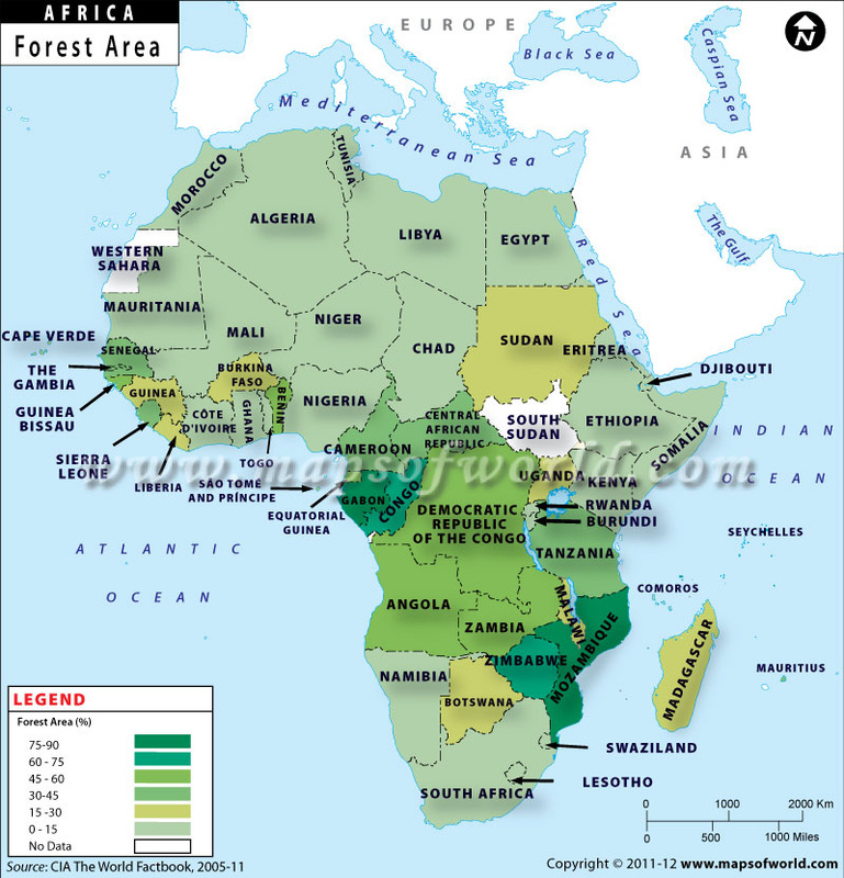
(Maps of World 2005-11)
Equatorial Guinea is located under the letter P of the word MAP. It is shown to have between 45 and 60 percent of forest area.
The map above is of the different climates of Africa. When you zoom into Equatorial Guinea you see that it is a dark green color which means that the climate in that particular country of Africa is Tropical Wet.
Male and Female Population of Equatorial Guinea
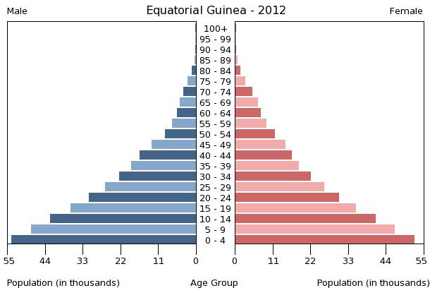
(CIA 2012)
Population Pyramids
In 1950, there was a typical pyramid shape to the population of Equatorial Guinea. There were more children than the rest of the population, and as the ages increased the amount of persons per age decreased. This pyramid shows that many did not live past 80 or 84.
http://populationpyramid.net/Equatorial+Guinea/1950/
60 years later, in 2010 the pyramid took on a much different appearance. There was many children still, but around the age of 30, there was a major diminish in population for that increase. but as the ages increased there were more in that age category. Around the age of 40 though, the population for the elderly began to take its natural course and started to dwindle down with the elderly. Since 1950 there was increase in how long the elderly live from 84 to around 89.
http://populationpyramid.net/Equatorial+Guinea/2010/
DIPITY TIMELINE URL
http://www.dipity.com/pamillan/Equatorial-Guinea_1/#
Citations
History World. (n.d.). History of equatorial guinea. Retrieved from http://www.historyworld.net/wrldhis/plaintexthistories.asp?historyid=ad38
Maps of World. (Producer). (2012). Political map of equatorial guinea. [Print Photo]. Retrieved from http://www.mapsofworld.com/equatorial-guinea/equatorial-guinea-political-map.html
Maps of World. (Photographer). (2005-11). Africa forest areas. [Print Photo]. Retrieved from http://www.mapsofworld.com/africa/thematic/countries-by-forest-area.html
CIA. (Designer). (2012). Equatorial guinea 2012. [Web Graphic]. Retrieved from https://www.cia.gov/library/publications/the-world-factbook/population/populationtemplate_EK.html
Photo of Flag:
Raymond, N. (Photographer). (2012). Equatorial guinea grunge flag. [Web Photo]. Retrieved from http://somadjinn.deviantart.com/art/Equatorial-Guinea-Grunge-Flag-287433471
